ADVERTISEMENT

Who else gets lost in Google Maps?

Feb 9, 2013
29,188
84,974
113
I can spend hours on Google Maps exploring and dropping in and out of street view. It’s amazing how you can look at places you’ve been, look into potential vacation or recreation spots or just explore random cities around the world.

Anyone else do this or am I the only map geek?
 
It's definitely the best app for directions I've seen. Much better than Garmin and others at locating stores that are in strip malls, IDing traffic accidents/alternative routes.

My only complaint, and it's as much on the businesses as the app I think, is that business information isn't always accurate.
 
I have spend time looking at prisons in China and North Korea.

as technology improves its going to be really crazy. P
Looking at North Korea is interesting.
Tons of monuments and statues but almost no crowds. Maybe an occasional group of people with the same vacant stares. What an awful place to live.
 
I now use satellite view to find backwaters on the Mississippi for potential fishing spots. Have to pay attention to the time of year (leaves versus no leaves, etc) and whether beaches on the channel are exposed to know if what I see is actually accessible.

Found a pond last year that yielded the best MR bluegills I've caught in over a decade. Never knew it was there prior. Not even 3 miles by air away but took about 10 boat miles and an hour of searching to find it. It's only accessible in high water - wouldn't be able to get in there today.
 
Ok so I am going to post pre maturely. Have to find the link.

There is a website that is based on goggle maps that makes a game of guessing where in the world the view is located. You get a goggle map view, street level. You can move around your view to get better looks. You then drip a pin where in the world you think it is located. Score points based on distance you miss.

Very addictive, more so than HROT. Its in office pc at home. Will post later today when off the water.

Example: Was given a location that looked very similar to Iowa. A John Deere tractor, newer 4200 series, looked like a 4210 was by a corn field. As I panned around 1 vehicle a Ford pick up could be seen. The only unique characteristics I could find was the license plate was English but definately not anything close to a state plate. I guessed Argentina as I know a lot of US farmers over the years have moved that way as agriculture has developed in South America. Way off, turned out it was in southwest Australia.

Anyway will see if I can get it posted later.
 
  • Like
Reactions: PoopandBoogers
I do this, although usually don't go to street view. Having traveled extensively across the western US and plains, I've spent a lot of time looking at oddball highways and out of the way destinations.
 
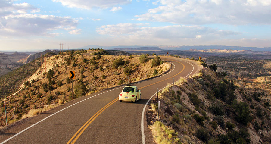
Highway to do before you die: highway 12 in south central Utah between Bryce and Escalante. You'll understand why the Grand Staircase-Escalante National Monument was created.


8050_ScenicByway12_C_72_11e54b8a-26fc-4f67-801f-5b7b5731fb8c.jpg
 
  • Like
Reactions: mthawkeyes
The google map game is addicting as hell. Just found it, it's called Geoguessr. Looks like you have to create a free account to play it now though.

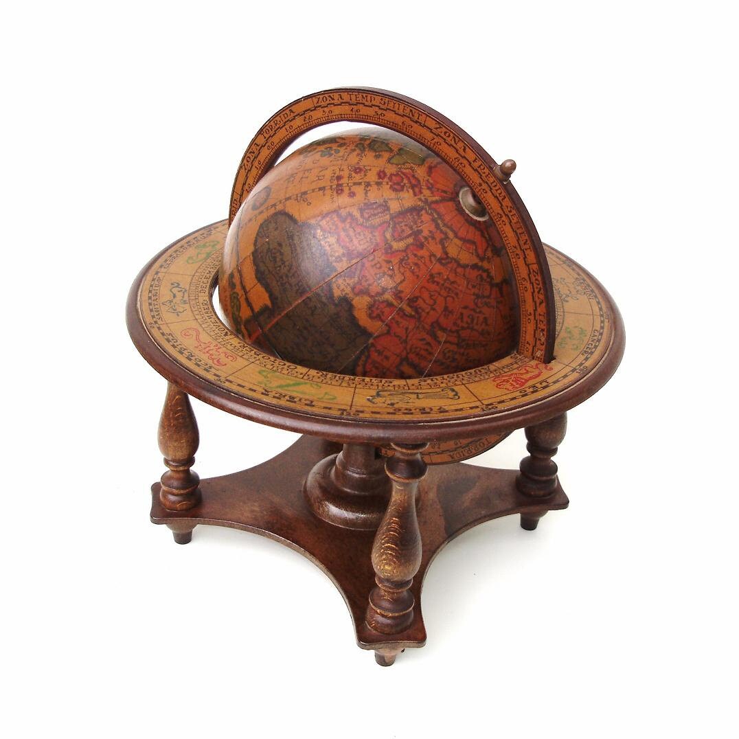
I love maps, have several framed and hanging around the house, along with and old world globe that I look at to see how close they really came to reality.
il_fullxfull.836822577_9vjf.jpg


On google maps I can waste hours looking for point breaks and reef breaks for hidden and outta the way surf spots. I'm still looking to see if I can find my car on there, but after years of searching, I still can't find it.
 
I don't do it a lot but I do enjoy it. Google street view will give you a much better idea of what a place looks like in reality. Especially if you start wondering about the non tourist areas.

It's amazing that you can see most anything from the biggest cities to some of the most remote places on earth.
 
When I go to my cabin in NE Iowa on the weekends, I like to take different routes all the time, especially different gravel and remote roads. I add a lot of unnecessary miles, but I see a lot of cool things. Then on Monday when I'm bored at work I like to use google maps to track exactly where I was.
 
  • Like
Reactions: TheCainer
Highway to do before you die: highway 12 in south central Utah between Bryce and Escalante. You'll understand why the Grand Staircase-Escalante National Monument was created.


8050_ScenicByway12_C_72_11e54b8a-26fc-4f67-801f-5b7b5731fb8c.jpg
Yes, that’s a fantastic drive.
 
Highway to do before you die: highway 12 in south central Utah between Bryce and Escalante. You'll understand why the Grand Staircase-Escalante National Monument was created.


8050_ScenicByway12_C_72_11e54b8a-26fc-4f67-801f-5b7b5731fb8c.jpg
you should try this. Looking glass bridge separates the Atlantic from the Caribbean.

 
I can spend hours on Google Maps exploring and dropping in and out of street view. It’s amazing how you can look at places you’ve been, look into potential vacation or recreation spots or just explore random cities around the world.

Anyone else do this or am I the only map geek?
All the time. I mentioned in the thread I started about the epic labors of Chinese laborers to cut through the Sierras to build the transcontinental railroad that I followed the route as I read. Absolutely fascinating to follow every twist and turn to see the twists and turns, the snow sheds, the tunnels, and imagine the difficulty in working out in the open in extreme conditions.
 
Had never thought to explore google maps in the way some of you have but thanks to this thread i am about to embark...would copacabana beach be a worthy destination?
 
Looking at North Korea is interesting.
Tons of monuments and statues but almost no crowds. Maybe an occasional group of people with the same vacant stares. What an awful place to live.
Sure, but finding a good parking spot is usually easy.
I've also looked at N. Korea. Not just NK, but it's amazing to move around and see which countries are effective at blocking the view of parts of their countries. Israel is hyper aggressive about blocking images.
For fun I like to check out various military installations. Fun to zoom in and out and see equipment fade in and out of view. B2 bombers on the ground at Whiteman AFB until you zoom in too close. The naval base at San Diego gets pixelated out quite a bit. It is nice to see that despite the climate changing denials of the Trump Administration, and the promise to bring back clean coal, the US military is building vast solar fields on it's bases.
 
ADVERTISEMENT

Latest posts

ADVERTISEMENT