Can't update this often since I'm in Dallas, however, this needs to be seen:
Parts of Eastern Iowa and the quad cities are going to be placed under a high risk threat for strong tornadoes. This is the highest risk level from the Storm Prediction Center.
Parts of Eastern Iowa and the quad cities are going to be placed under a high risk threat for strong tornadoes. This is the highest risk level from the Storm Prediction Center.
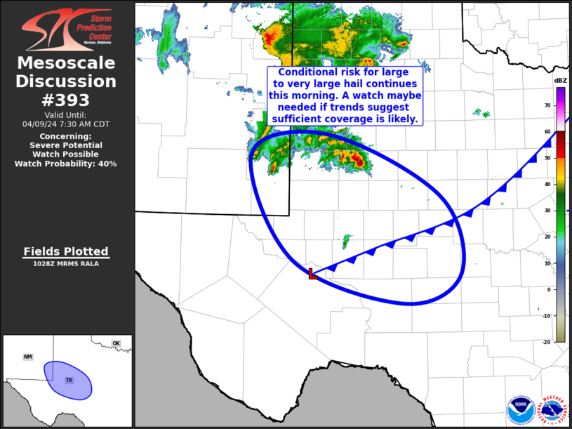
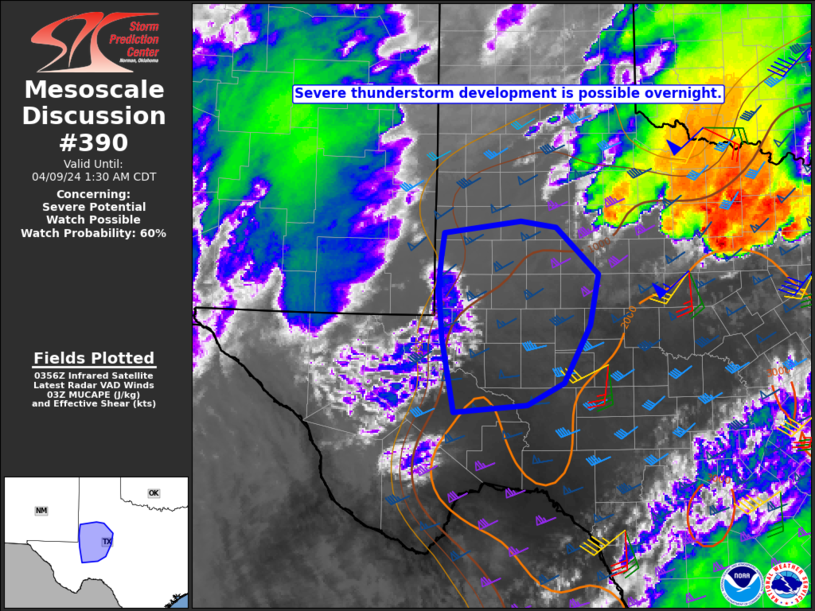
Storm Prediction Center Mesoscale Discussion 390
Severe weather, tornado, thunderstorm, fire weather, storm report, tornado watch, severe thunderstorm watch, mesoscale discussion, convective outlook products from the Storm Prediction Center.
www.spc.noaa.gov
DISCUSSION...An upgrade to a tornado-driven High Risk (30%
probability) is expected for the 1630 UTC outlook. Environmental
conditions are quickly becoming favorable to support the potential
for numerous strong to potentially violent and long-track tornadoes
across portions of southeastern IA, northwestern IL, and far
northeastern MO. Please see the forthcoming Day 1 outlook update for
more information.
Last edited: